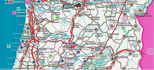
It is the seat of the municipality of Resende, with a total area of 123.35 km2, 10,051 inhabitants in 2021 and a population density of 81 inhabitants per km2, subdivided into 11 parishes. The municipality is limited to the north by the municipalities of Baião and Mesão Frio, to the east by Lamego, to the south by Castro Daire and to the west by Cinfães.
Parishes
The municipality of Resende is currently divided into eleven parishes:
Built heritage:
Castelo de São Martinho de Mouros
Conjunto Megalítico de Felgueiras
Mosteiro de Santa Maria de Cárquere
Igreja de São Martinho de Mouros
Panchorra is an old Portuguese parish in the municipality of Resende, with an area of 13.25 km² and 132 inhabitants (2011). Its population density was 10 inhabitants/km².
Its high altitude (in the parish seat it is 1088 m) makes it one of the highest villages in Portugal.
Patrimony
Parish Church of Panchorra;
Chapel of Bom Sucesso;
Chapel of São Sebastião;
Visitation Chapel;
Panchorra Bridge.
Located about 1000 meters above sea level, joining the banks of the river Cabrum, the Bridge of Panchorra is a beautiful example of vernacular [traditional] architecture.
A two-arched bridge, it presents a regular structure in the voussoirs [stones forming the arch] and irregular masonry [stones] in the remaining structure, which may indicate a work of local or regional masters, intended to meet the access needs of the community to their farms and forests.
Accordingly, it distances itself in importance and technique from its counterparts, built downstream, including the bridges of Ovadas, Lagariça and Nova, almost at the mouth of the river Cabrum. However, it still stands as a fine example of community infrastructure.
The crossing takes advantage of the outcrops on the riverbanks to support its pillars, upon which the horizontal deck with guards stands, providing it with the necessary sturdiness for farm vehicles and livestock to cross.
Although Panchorra is already mentioned in the Inquirições [administrative enquiries] of 1258, only in the 16th century was it separated from Ovadas, where the former religious centre of the medieval parish was located.
It became, thus, a “curato” [parish], with the Chapel of Saint Lawrence serving as the new religious centre.
Santa Comba Dão;
Santar (Nelas);
São João da Pesqueira + Trevões;
São Pedro do Sul;
São Pedro do Sul - Spa ;
Sátão;
Sernacelhe;
Tabuaço;
Tarouca + Ucanha;
Tondela;
Ventosa (Vouzela);
Vila Nova (Ventosa);
Vila Nova de Paiva;
VISEU;
Vouzela;


