CASTRO DAIRE
40º 54' N; 7º 56´ W
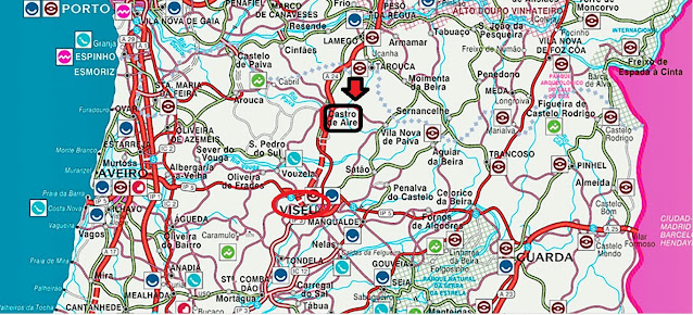
Castro Daire is a Portuguese village in the district of Viseu, located in the province of Beira Alta, in the Center region (Region of Beiras) and sub-region Viseu Dão-Lafões, with about 4 600 inhabitants.
It is the seat of the municipality of Castro Daire with an area of 379.04 km² and 13,736 inhabitants (2021), subdivided into 16 parishes. The municipality is limited to the north by the municipalities of Cinfães, Resende, Lamego and Tarouca, to the east by Vila Nova de Paiva, to the south by Viseu, to the southwest by São Pedro do Sul and to the west by Arouca.
Economy
The municipality is economically underdeveloped, with weak purchasing power (only 45.5% of the national average) and a weak business fabric, low level of education, both for bosses and workers, with a high level of informality in business.
This picture is explained by the growing desertification of the region, the aging of the population and a certain accommodation of local entrepreneurs to the conditions, as a result of low education and difficulty in accessing technical, human and financial resources.
There is also a large primary sector (21.8% of the active population in 2001), as a result of the prevalence of survival agriculture practiced by the elderly population. In the secondary sector, emphasis on the wood and furniture industry (concentrated mainly in the parish of Castro Daire), the extraction of ornamental stones, mainly granite (concentrated in the village of Cela in the parish of Moledo) and bakeries (these spread throughout the county territory). These industries are small in size, with a low technological level, focused more on the exploitation of natural resources and sale to coastal regions or abroad and of a family nature (whose management is centered on its founder, depending a lot on his management skills) . In services, emphasis on the public and social sector (main employer of the young population), small businesses (with emphasis on the Intermarché and Continente Bom Dia supermarkets and restaurants), photography studios, repair of household appliances, workshops and car stands, tourism (the Carvalhal Spa, the Hotel do Montemuro] and the Casa de Turismo de Fareja) and civil construction (probably the largest employer).
It should be noted that unemployment is high (very close to 10%), which mainly affects the female population and which leads to a low activity rate (close to 35%). Given this situation, productivity is low and, consequently, incomes are, on average, low.
In recent years, an industrial park has been installed in Ouvida, with relative development, but very dependent on subsidies from the State and the European Union. There is also the intention to invest in tourism.
The parishes of the municipality of Castro Daire are the following:
Almofala
Cabril
Castro Daire
Cujó
Gosende
Mamouros, Alva e Ribolhos
Mezio e Moura Morta
Mões
Moledo
Monteiras
Parada de Ester e Ester
Pepim
Picão e Ermida
Pinheiro
Reriz e Gafanhão
São Joaninho
Villages and other places in the Municipality:
Colo de Pito
Custilhão (ou Costilhão)
Outeiro de Eiriz
Vitoreira
Sobreda
Cetos
Eiriz (Parada de Ester)
Ester de Cima
Faifa
Farejinhas
Fareja
Baltar
Grijó de Mões
Meã
Moção
Mortolgos
Mós (Parada de Ester)
Pereira (Pinheiro)
Relva
Cetos
Towns in the County:
Mões
Patrimony
Mother Church of Castro Daire
Church of Nossa Senhora da Conceição, National Monument in the parish of Ermida.
Mother Church of Castro Daire
Maria da Fontinha House-Museum, in the parish of Gafanhão.
Pelourinhos de Mões, Campo Benfeito, Rossão and Castro Daire
Penedo de Lamas inscription
Ruínas da Muralha das Portas de Montemuro
💛💛💛💛💛
Igreja de Nossa Senhora da Conceição (Ermida)
40° 55′ 20″ N, 7° 58′ 12″ W
Church of Our Lady of Conception (ERMIDA)
The Church of Nossa Senhora da Conceição was part of a monastery in Ermida do Paiva, located 6 km from Castro Daire, in the parish of Picão e Ermida, with current access via National Road 225.
The Ermida and the monastery are also known as Mosteiro da Ermida, Igreja de Nossa Senhora da Conceição and Igreja das Siglas.
History
It is a monument from the second half of the 12th century. Its foundation is given as having happened in the Era of Caesar in 1178, founded by D. Roberto, a French monk, of the Premonstratensian Order, on a crown estate, with D. Afonso III being the patron himself.
Architecture
It is an amazing monument, the façade faces west, according to the classic liturgical orientation, but not with the exact East/West alignment.
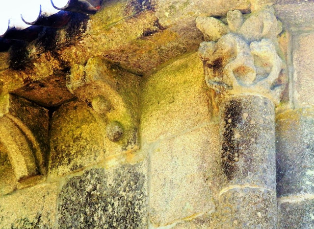
It is a monument in the Romanesque style, although the mass of the building features characteristically Gothic elements. Thick walls accompanied, up to the cornice, by prismatic buttresses, secure props to guarantee the success of the person responsible for the risk and execution, carved corbels, where, crudely and in an authentic anarchy, human figures, frowns, ropes, fruits, rings are carved , flowers and various geometric elements.
Riodades (São João da Pesqueira);
Santa Comba Dão;
Santar (Nelas);
São João da Pesqueira + Trevões;
São Pedro do Sul;
Santa Comba Dão;
Santar (Nelas);
São João da Pesqueira + Trevões;
São Pedro do Sul;
São Martinho de Mouros (Resende);
São Pedro do Sul - Spa ;
Sátão;
Sernacelhe;
Tabuaço;
Tarouca + Ucanha;
Tondela;
São Pedro do Sul - Spa ;
Sátão;
Sernacelhe;
Tabuaço;
Tarouca + Ucanha;
Tondela;
Várzea - São Pedro do Sul (Spa);
Ventosa (Vouzela);
Vila Nova (Ventosa);
Vila Nova de Paiva;
VISEU;
Vouzela;
Ventosa (Vouzela);
Vila Nova (Ventosa);
Vila Nova de Paiva;
VISEU;
Vouzela;
💓💓💓💓💓
Return to mainland Portugal &
the Azores and Madeira islands


